Captain & Crew Charters
About
Gallery
Trip details
- Fishing Types
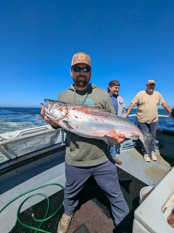
- Offshore / Deep Sea, Salmon & Steelhead
Fishing spots near Captain & Crew Charters
Loads the full map of the fishing spots near this listing. We leave it off by default so the page opens fast on mobile data.
- Westhaven CoveBayGrays Harbor County, WA
- Armstrong BayBayGrays Harbor County, WA
- Cohassett LakeLakeGrays Harbor County, WA
- South BayBayGrays Harbor County, WA
- Duck LakeLakeGrays Harbor County, WA
- Grays HarborBayGrays Harbor County, WA
- Johns RiverStreamGrays Harbor County, WA
- Sopun InletBayGrays Harbor County, WA
Angler reviews
What anglers are saying
- EEmily Gnagey· 3 months ago
In the area for just a short time, Alyssa and Mike arranged a quick hour-long trip around the harbor and then a kiss of the Pacific Ocean for our family. We got to see the Sea Lions up close and the seagulls basking on the rocks. Mike and Alyssa were so great with our kids too. A very memorable experience. We could not have been more impressed and delighted with the crew!
- VVanessa Brower· 5 months ago
Capt Tom and Deckhand Skylar are fantastic! We limited out on lingcod and bottom fish in three hours! We were on the boat "Cormorant". Boat and gear are well maintained. Bring your fish license, rain gear and food. There's a microwave on board.
- TTommi Bemis· a year ago
We caught our limit of Salmon and rock fish. We returned to dock early! Captain Tom and Skyler were right there to help with everything we needed. They were friendly and we will be returning for Halibut season. I highly recommend Captain Tom and his crew.
- RRobert Barton· 4 months ago
I just returned from 3rd annual halibut deep water trip, and again wasn't disappointed! Every time out, I catch my limit during the first couple hours, move to Lincod and catch limit in an hour or two, then start heading back in before noon! I did a quick calculation, and the 20 lb. of cleaned fish that I bring home are worth at least $400 at the grocery store... so my trip pays for itself!
Reviews powered by Google. Content belongs to its respective authors.
Typical flow by month
1973 to 2026
The water at Captain & Crew Charters typically runs highest in January, at a median 1,970 cfs, and lowest in August, at 212 cfs. The highest flow on record for any single day is 23,700 cfs, in 1997.
| Month | Typical (cfs) | Usual range (cfs) | Relative level |
|---|---|---|---|
| January | 1,970 | 1,070 to 3,290 | |
| February | 1,430 | 919 to 2,460 | |
| March | 1,270 | 780 to 2,080 | |
| April | 816 | 624 to 1,200 | |
| May | 516 | 390 to 764 | |
| June | 395 | 305 to 615 | |
| July | 279 | 232 to 353 | |
| August | 212 | 179 to 252 | |
| September | 249 | 191 to 379 | |
| October | 402 | 229 to 831 | |
| November | 1,710 | 806 to 3,265 | |
| December | 1,960 | 1,100 to 3,330 |
Typical is the median of each month’s daily median values, and the usual range runs from the median 25th to the median 75th percentile, across about 53 years of record. Statistics published by the US Geological Survey for Wynoochee River above Black Creek near Montesano, WA (site 12037400). Conditions on any given day can fall well outside the usual range. Check the current reading before you go.
Current conditions
Waves
3.4 ft @ 6s
Wind
3 kt
Gusts 15 kt
Water
60°F
Air
52°F
Streamflow
175 cfs
Below normal (17th)
Water level
26.98 ft
Rain chance
2%
Forecast outlook
Forecast from Open-Meteo global models (NOAA & ECMWF). See full conditions →
More guides in Washington
Also nearby
Other ways to get outside within about an hour of here.
Free tools
Your free outdoor toolkit

Everything Map
Listings, trails, spots, clubs and public land on a single full-screen map. Switch layers on and off, then tap any point for the details.
Open Everything MapFishing Spots
Browse 24,783 named waters, then read the state stocking record: species, size, and when.
Open Fishing SpotsRiver Explorer
Explore named rivers from the USGS hydrography dataset. Filter by water type or whitewater class.
Open River ExplorerRoute Planner
Drop stops on a map and watch distance and drive time add up. Export a GPX or share the link.
Open Route PlannerFishing Clubs
Browse local clubs with meeting info and how to join, or start your own for free.
Open Fishing ClubsLive Conditions
Real-time conditions spot by spot, pulled from public weather feeds, before you commit to the drive.
Open Live Conditions