Columbia River Fishing Guides
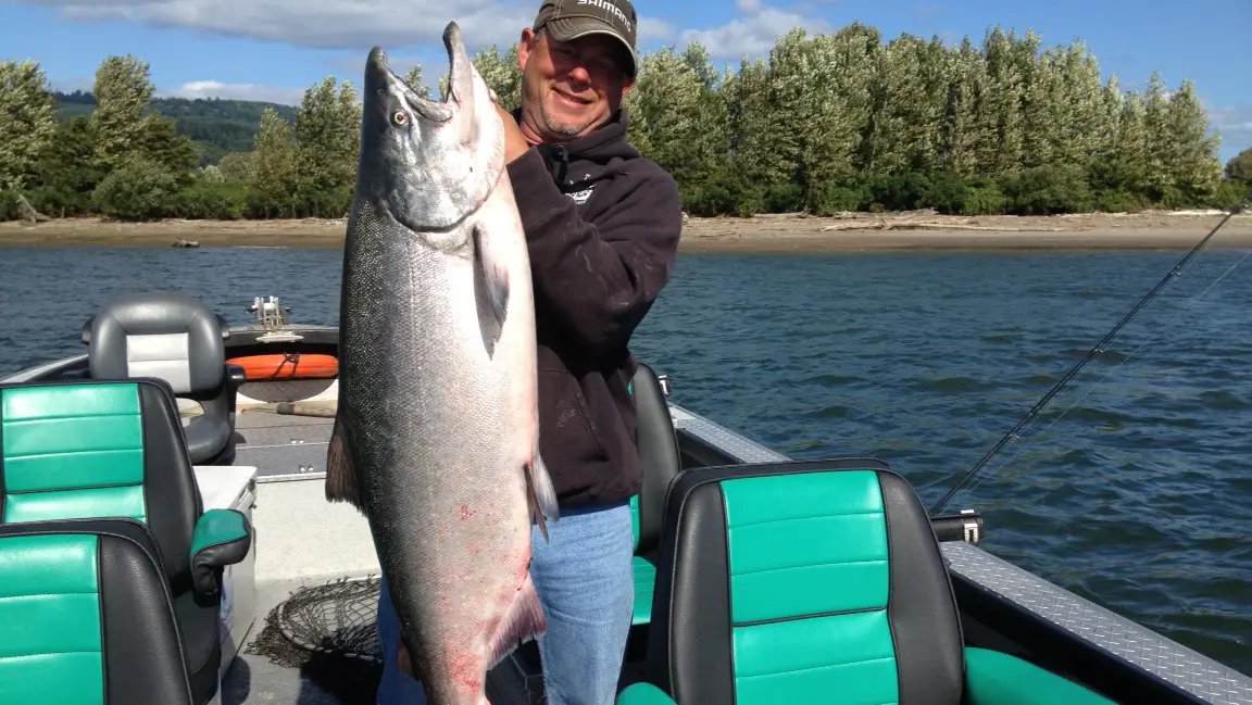
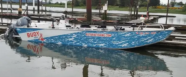
Columbia River Fishing Guides is a fishing charter and guide service based in Kalama, WA.
Gallery
Trip details
- Fishing Types
- Salmon & Steelhead
- Trip Durations
- half-day, full-day
Fishing spots near Columbia River Fishing Guides
Loads the full map of the fishing spots near this listing. We leave it off by default so the page opens fast on mobile data.
- Kalama Upper RangeChannelColumbia County, OR
- Kalama Upper RangeChannelCowlitz County, WA
- Kalama Lower RangeChannelCowlitz County, WA
- Kalama Lower RangeChannelColumbia County, OR
- Kalama RiverStreamCowlitz County, WA
- Bybee Ledge ChannelChannelColumbia County, OR
- Cottonwood LakeLakeColumbia County, OR
- Deer Island SloughLakeColumbia County, OR
Angler reviews
What anglers are saying
- TTaryn Wilder· 2 months ago
This was the best experience we ever had! We called last minute and he delivered. He knows how to get you hooked on and get the fish you're looking for! Very professional. We only use him from now on!!
- KKoty Crocker· 5 months ago
We booked an elk hunt through Christian’s other company Washington hunting outfitters (18,000$ for our group) Christian never showed up. Had someone else show in his place, then the hunt was totally opposite of everything we was sold. We put on over 10 miles a day apiece and never seen a legal bull. Seen other hunters every day and plenty more hunters than elk. Absolute joke, of he’ll do that on an elk hunt he will dang sure do it for a fishing trip.
- CCrystal Sworden· 3 years ago
Amazing day on the river! Let me start off by saying that this was my families first guided fishing trip and wasn't sure at all what to expect. The plan was to do Salmon fishing but we were told earlier in the day the reports weren't good and there wasn't much activity in the area we were going. We all discussed our expectations which was that there was no guarantee we would catch anything. Sad but true fishing is not guaranteed or it would be called "catching" instead according to a family member. We were told the following to be prepared: layer clothing as it was cold that day but could warm up, pack snacks/lunch as it's not provided, sunscreen may be needed, and a hat for some of us. Also, goes without saying to have license and fishing licenses. Some of these items should be obvious but others not so much. A friend suggested we bring tip money as well. We had no expectations having never been on a trip such as this. We headed out of the marina with excitement in hopes as all of us probably hope of landing a big fish. Initially the spot we hit up north trolling for Salmon was a bust. But, our guide Christian made a call to get a report on a spot that had hits on Sturgeon instead. He let us know he couldn't guarantee anything but sounds like it might be a good place if we were up for it. Of course, we said let's do it. At this point even without a bite, for someone who works too much it was already a great day on the water, and no motion sickness which was huge. We headed towards Goat Island and he dropped anchor, got the first pole in the water, and as he was getting the second one in there was a hit right away on the line. Having little experience with Sturgeon fishing Christian was a great teacher explaining how, when, and in what order to do things. The first Sturgeon my husband caught was 2-3' but huge smile on his face none the less. Not long after getting all the poles on another bite came on the line, and my daughter got a decent sized sturgeon on the line, and learned how tiring they can be to land. Christian got it on the boat for a photo and we released it back into the water. We all ended up catching several Sturgeons and I ended up catching a large one that was between 6-7' and estimated to weigh 150 lbs. This one we were all nervous to get on the boat but Christian managed it somehow. He advised in a laughing tone any other larger one's would not be on the boat. We ended the evening with all of us having caught multiple sturgeons, smiles on our face, excitement, and looking forward to the next excursion. Even me whose body doesn't do well on the water. I will absolutely suggest him to friends, family, colleagues, and strangers. All around amazing experience and still smiling days later. Coming in from the day I snapped a photo of our guide looking completely as home on the boat and my experience was he was just that. He gave us an amazing afternoon/evening.
- DDixie Garcia· 3 months ago
My boyfriend and I had an amazing day with Christian there were a total of 5 on the tour and we caught more then 25 it was amazing had a blast! Will do again for sure.
Reviews powered by Google. Content belongs to its respective authors.
Typical flow by month
1969 to 2026
The water at Columbia River Fishing Guides typically runs highest in May, at a median 329,000 cfs, and lowest in September, at 115,000 cfs. The highest flow on record for any single day is 864,000 cfs, in 1996.
| Month | Typical (cfs) | Usual range (cfs) | Relative level |
|---|---|---|---|
| January | 255,000 | 206,000 to 326,000 | |
| February | 227,000 | 187,000 to 297,000 | |
| March | 232,000 | 184,000 to 297,000 | |
| April | 272,500 | 202,000 to 354,500 | |
| May | 329,000 | 255,000 to 388,000 | |
| June | 289,000 | 222,000 to 409,000 | |
| July | 195,000 | 160,000 to 236,000 | |
| August | 149,000 | 133,000 to 175,000 | |
| September | 115,000 | 98,400 to 133,500 | |
| October | 125,000 | 107,000 to 150,000 | |
| November | 177,000 | 157,000 to 203,000 | |
| December | 232,000 | 179,000 to 290,000 |
Typical is the median of each month’s daily median values, and the usual range runs from the median 25th to the median 75th percentile, across about 36 years of record. Statistics published by the US Geological Survey for Columbia River at Port Westward, near Quincy, OR (site 14246900). Conditions on any given day can fall well outside the usual range. Check the current reading before you go.
Current conditions
Streamflow
141,000 cfs
Above normal (80th)
Water level
2.99 ft
High today
72°F
Wind
8 kt
Gusts 14 kt
Rain chance
1%
Week ahead
Forecast from Open-Meteo global models (NOAA & ECMWF). See full conditions →
More guides
Also nearby
Other ways to get outside within about an hour of here.
Free tools
Your free outdoor toolkit

Everything Map
Listings, trails, spots, clubs and public land on a single full-screen map. Switch layers on and off, then tap any point for the details.
Open Everything MapFishing Spots
Browse 24,783 named waters, then read the state stocking record: species, size, and when.
Open Fishing SpotsRiver Explorer
Explore named rivers from the USGS hydrography dataset. Filter by water type or whitewater class.
Open River ExplorerRoute Planner
Drop stops on a map and watch distance and drive time add up. Export a GPX or share the link.
Open Route PlannerFishing Clubs
Browse local clubs with meeting info and how to join, or start your own for free.
Open Fishing ClubsLive Conditions
Real-time conditions spot by spot, pulled from public weather feeds, before you commit to the drive.
Open Live Conditions