Current Fly Fishing
About
- Quality instruction at your pace.
Gallery
Trip details
- Price Range
- 425-600
- Best Season
- Sept- Oct
- Fishing Types
- Trout Fishing
Fishing spots near Current Fly Fishing
Loads the full map of the fishing spots near this listing. We leave it off by default so the page opens fast on mobile data.
- Highland ReservoirReservoirWashoe County, NV
- Manzanita LakeReservoirWashoe County, NV
- West Wash ReservoirReservoirWashoe County, NV
- Lower Peavine Creek ReservoirReservoirWashoe County, NV
- East Wash ReservoirReservoirWashoe County, NV
- Upper Peavine Creek ReservoirReservoirWashoe County, NV
- Virginia LakeReservoirWashoe County, NV
- Hunter Creek ReservoirReservoirWashoe County, NV
Angler reviews
What anglers are saying
- EElizabeth Bouma· 4 months ago
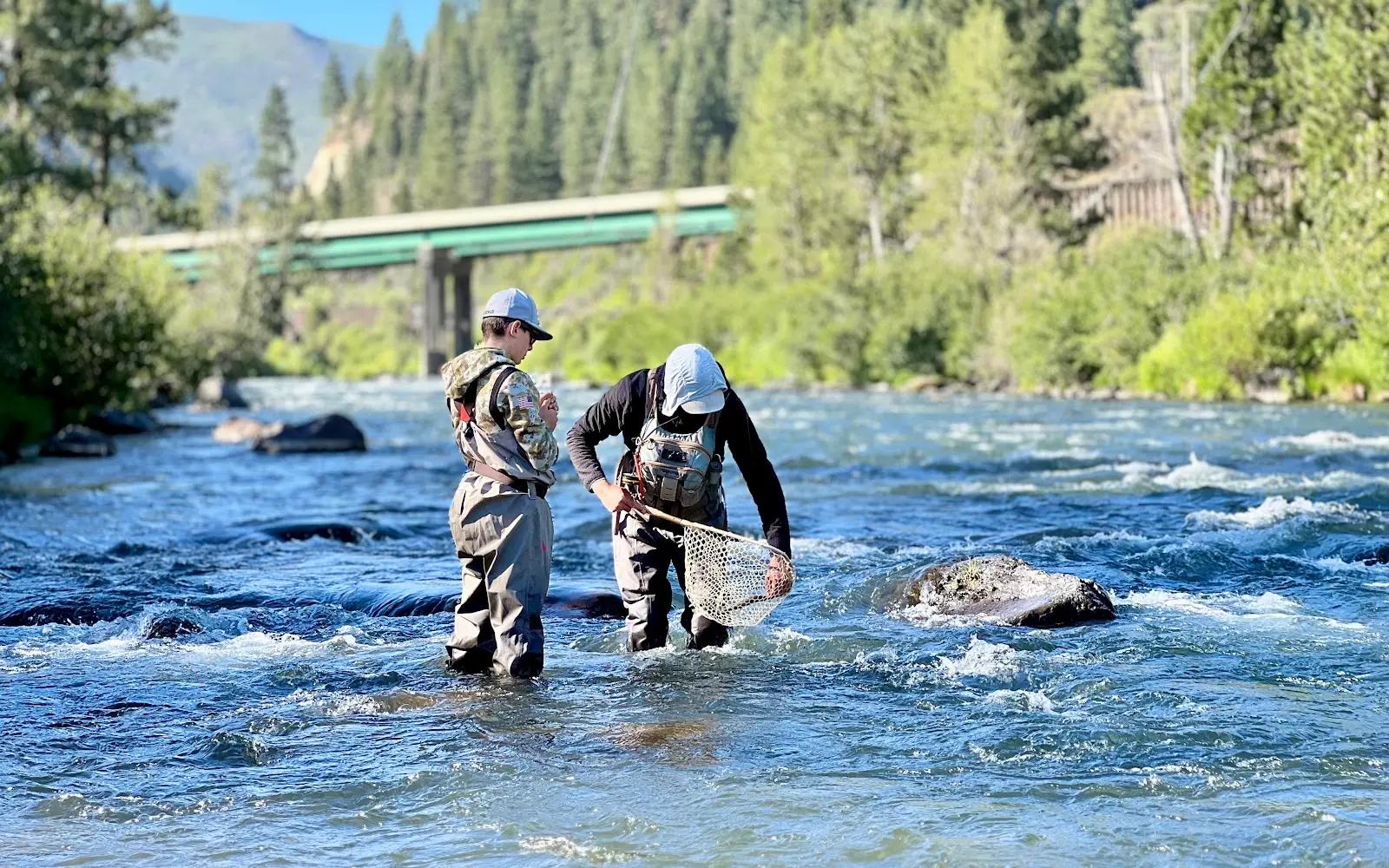
We had a wonderful time fly fishing with Dave and his adorable dog, Blue, as our guides on the Truckee River. Dave was friendly, kind, professional, and came fully prepared with all the necessary equipment. Didn’t catch any fish, but we’re enthusiastic about trying again sometime soon.
- AAurora Gutierrez· 2 months ago
We definitely started with a little plot twist 🤣 by buying Nevada fishing licenses instead of California (learn from us, everyone—buy the correct state license!). But instead of letting it ruin the day, we rolled with it, Dave found us an awesome Nevada spot, and turned our mistake into part of the adventure. The waders were MVPs because that water is COLD! My son caught a fish… and a rock 🤣, so we’re calling that a successful first fly-fishing trip. And Blue… that sweet girl She was convinced every human existed to pet her, and honestly, she wasn’t wrong. Give her extra scratches!
- RRich Gere· 3 months ago
A true fly fishing guide in every sense, knowledgeable, patient, and deeply attuned to the river, with an easy going nature that makes the whole day feel effortless. He reads the water like a living page, sharing not just technique but a genuine understanding of timing, movement, and respect for the craft. More than a guide, he’s a likable and generous teacher of river wisdom. An experience that goes beyond fishing and stays with you long after the line is reeled in.
- DDoug “Fresh”· 2 months ago
We had a great time learning fly fishing techniques from Dave Harvey. This was my first time fly fishing, and Dave did an outstanding job explaining everything we needed to do to be successful on the water. I would highly recommend Current Fly Fishing to anyone who wants an incredible fly fishing experience!
Reviews powered by Google. Content belongs to its respective authors.
Typical flow by month
1907 to 2026
The water at Current Fly Fishing typically runs highest in May, at a median 1,020 cfs, and lowest in August, at 238 cfs. The highest flow on record for any single day is 16,200 cfs, in 1956.
| Month | Typical (cfs) | Usual range (cfs) | Relative level |
|---|---|---|---|
| January | 390 | 283 to 559 | |
| February | 414 | 303 to 614 | |
| March | 550 | 400 to 1,070 | |
| April | 820 | 514 to 1,485 | |
| May | 1,020 | 645 to 1,930 | |
| June | 588 | 284 to 1,355 | |
| July | 275 | 173 to 438 | |
| August | 238 | 161 to 342 | |
| September | 250 | 155 to 339 | |
| October | 310 | 155 to 373 | |
| November | 339 | 239 to 426 | |
| December | 369 | 256 to 476 |
Typical is the median of each month’s daily median values, and the usual range runs from the median 25th to the median 75th percentile, across about 103 years of record. Statistics published by the US Geological Survey for Truckee RV at Reno, NV (site 10348000). Conditions on any given day can fall well outside the usual range. Check the current reading before you go.
Current conditions
Streamflow
381 cfs
Above normal (80th)
Water level
4.33 ft
High today
83°F
Wind
10 kt
Gusts 18 kt
Rain chance
2%
Week ahead
Forecast from Open-Meteo global models (NOAA & ECMWF). See full conditions →
More guides
Also nearby
Other ways to get outside within about an hour of here.

Free tools
Your free outdoor toolkit

Everything Map
Listings, trails, spots, clubs and public land on a single full-screen map. Switch layers on and off, then tap any point for the details.
Open Everything MapFishing Spots
Browse 24,783 named waters, then read the state stocking record: species, size, and when.
Open Fishing SpotsRiver Explorer
Explore named rivers from the USGS hydrography dataset. Filter by water type or whitewater class.
Open River ExplorerRoute Planner
Drop stops on a map and watch distance and drive time add up. Export a GPX or share the link.
Open Route PlannerFishing Clubs
Browse local clubs with meeting info and how to join, or start your own for free.
Open Fishing ClubsLive Conditions
Real-time conditions spot by spot, pulled from public weather feeds, before you commit to the drive.
Open Live Conditions