Guntersville Bass Guides
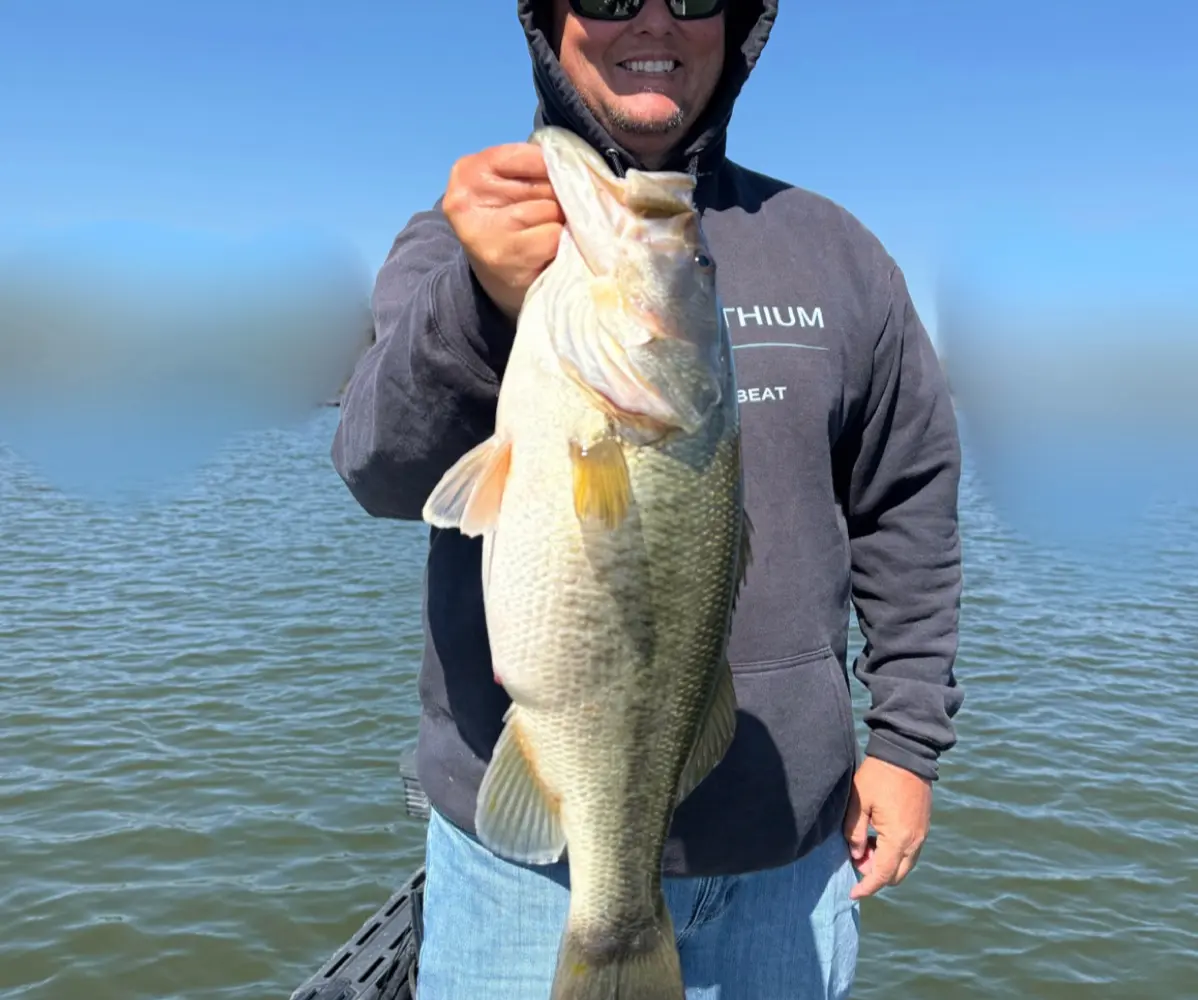
Guntersville Bass Guides is a fishing guide service based in Guntersville, Alabama.
Gallery
Fishing spots near Guntersville Bass Guides
Loads the full map of the fishing spots near this listing. We leave it off by default so the page opens fast on mobile data.
- Moore Pond (historical)LakeMarshall County, AL
- Smith LakeLakeMarshall County, AL
- Guntersville LakeReservoirMarshall County, AL
- Pine LakeReservoirMarshall County, AL
- Spring LakeReservoirMarshall County, AL
- Moman LakeReservoirBlount County, AL
- Curtis Williams LakeReservoirBlount County, AL
- Lynn Mill PondReservoirMarshall County, AL
Angler reviews
What anglers are saying
- EElad 22· 3 months ago
We fished with Captain Jim. He was nice enough to work with my schedule for the day. I travel with 2 small dogs and they needed a mid day break. I booked an 8 hour trip for two the last of April. We had storms the night before and high winds the morning of, however we were still on Big bass not long into the morning. I have fished allot of places and never caught this many big bass in one day. If you want to enjoy your day on the water learn a little about bass habits and laugh some this is the Captain for you. We had allot of fun and plan on staying in contact with Cpt Jim who knows 1 day he may come fishing with me.
- JJill Jones· a month ago
I booked a trip with Capt. Jim for my son. Jim took the time to teach him different bass fishing techniques. He showed him the value of slowing down and being patient while fishing. Jim was knowledgeable, patient and invested in helping him become a better angler. If you're looking for a guide who truly enjoys teaching and helping others improve their fishing skills, I highly recommend Captain Jim.
- NNico Deeb· 2 months ago
Just finished up 4 day/8 hour bass trip with Captain Jim and had a blast! This was my second multi-day trip with Captain Jim and I can’t recommend him enough!! He’s very knowledgeable, talented and helpful, not to mention just an all around great guy! Good conversation, great times and awesome fishing!!! Captain Jim and Guntersville Bass Guides is hands down the way to go! He will find the fish, put you on the fish and you WILL put plenty of fish in the boat! All around amazing times! Can’t wait for trip 3! Thank you Captain Jim!!
- EEthan Wheeler· 5 months ago
I have fished with Capt. Jim on numerous occasions including a Christmas gift to my father for a trip. Very knowledgeable of the lake and fish behavior, top notch service and absolutely no complaints. Numerous fish catches, very healthy size and lots of memories have been made. I will definitely be continuing my trips with Guntersville Bass Guides and highly recommend them to anybody that is wanting a take a trip down there!
Reviews powered by Google. Content belongs to its respective authors.
Typical flow by month
2021 to 2026
The water at Guntersville Bass Guides typically runs highest in December, at a median 127 cfs, and lowest in October, at 1.3 cfs. The highest flow on record for any single day is 2,490 cfs, in 2022.
| Month | Typical (cfs) | Usual range (cfs) | Relative level |
|---|---|---|---|
| May | 91 | 48 to 536 | |
| June | 47 | 22 to 204 | |
| July | 16 | 6.2 to 96 | |
| August | 16 | 4.2 to 43 | |
| September | 3.5 | 1.1 to 75 | |
| October | 1.3 | 0.8 to 50 | |
| November | 1.4 | 0.3 to 28 | |
| December | 127 | 29 to 447 |
Typical is the median of each month’s daily median values, and the usual range runs from the median 25th to the median 75th percentile, across about 5 years of record. Statistics published by the US Geological Survey for Cotaco Creek at Florette AL (site 03576148). Conditions on any given day can fall well outside the usual range. Check the current reading before you go.
Current conditions
Streamflow
2.8 cfs
Normal (50th)
Water level
2.61 ft
High today
86°F
Wind
7 kt
Gusts 16 kt
Rain chance
11%
Week ahead
Forecast from Open-Meteo global models (NOAA & ECMWF). See full conditions →
More guides in Alabama
Also nearby
Other ways to get outside within about an hour of here.
Free tools
Your free outdoor toolkit

Everything Map
Listings, trails, spots, clubs and public land on a single full-screen map. Switch layers on and off, then tap any point for the details.
Open Everything MapFishing Spots
Browse 24,783 named waters, then read the state stocking record: species, size, and when.
Open Fishing SpotsRiver Explorer
Explore named rivers from the USGS hydrography dataset. Filter by water type or whitewater class.
Open River ExplorerRoute Planner
Drop stops on a map and watch distance and drive time add up. Export a GPX or share the link.
Open Route PlannerFishing Clubs
Browse local clubs with meeting info and how to join, or start your own for free.
Open Fishing ClubsLive Conditions
Real-time conditions spot by spot, pulled from public weather feeds, before you commit to the drive.
Open Live Conditions