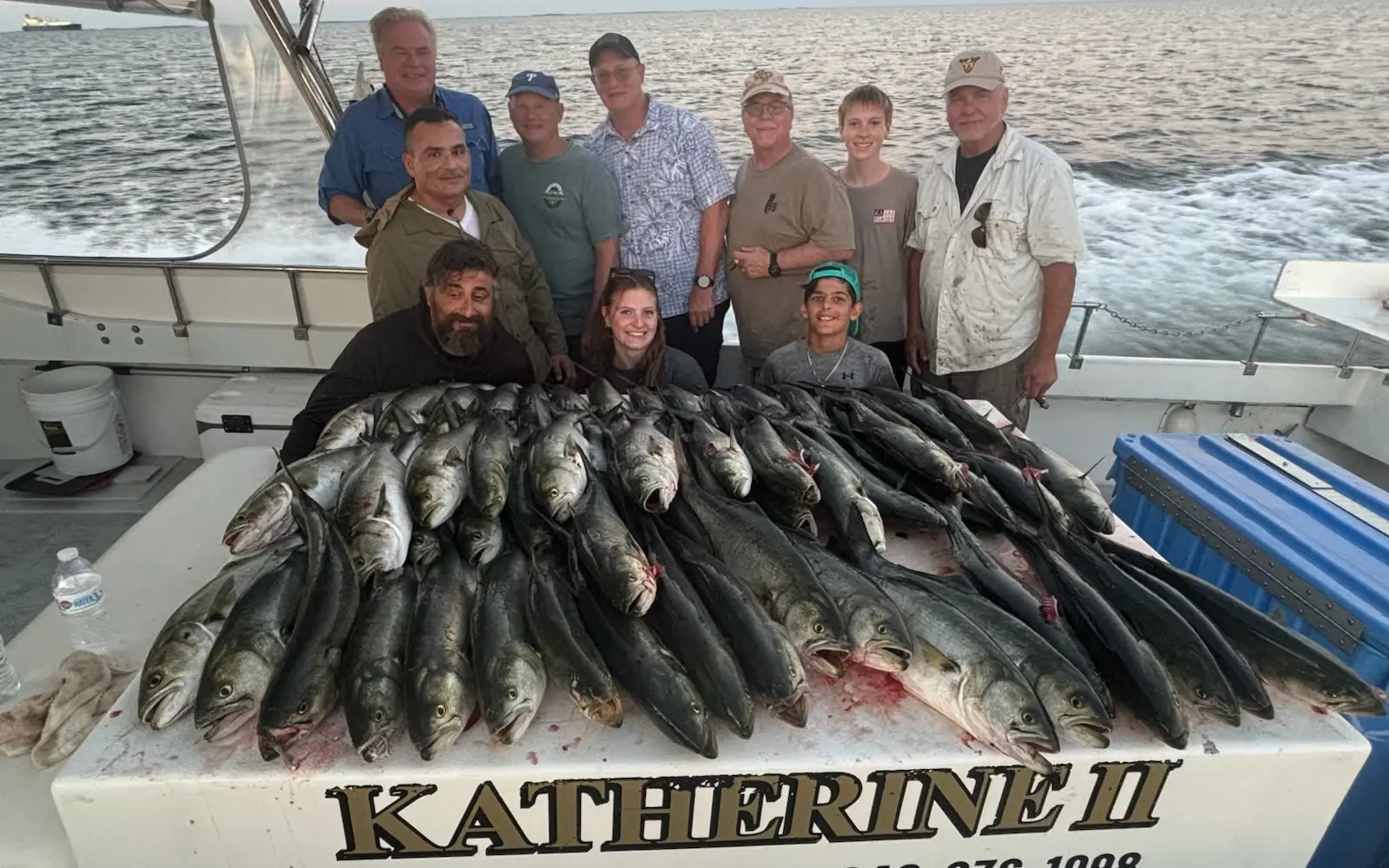
Katherine Charter Fishing
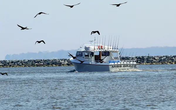
Katherine Charter Fishing is a fishing charter and guide service based in Chesapeake Beach, MD. They offer charter fishing in the Chesapeake Bay.
Gallery
Trip details
- Waters
- Chesapeake Bay
- Fishing Types
- Inshore Fishing
- Trip Durations
- half-day, full-day
Fishing spots near Katherine Charter Fishing
Loads the full map of the fishing spots near this listing. We leave it off by default so the page opens fast on mobile data.
- Herring BayBayAnne Arundel County, MD
- Herring Bay ViewBayAnne Arundel County, MD
- Parker CreekBayAnne Arundel County, MD
- Carrs CreekBayAnne Arundel County, MD
- Broadwater CreekBayAnne Arundel County, MD
- Hagerstown City Park LakeReservoirCalvert County, MD
- Deep CreekBayAnne Arundel County, MD
- Flag PondLakeAnne Arundel County, MD
Angler reviews
What anglers are saying
- GGeorge Byrd· 2 months ago
Katherine Charter fishing is hands down the greatest fishing experience I have ever had. I have been fishing for over 50 years. Captain Sam and his mate Captain Dave truly know how to show you a good time (and catch fish too!). We have been fishing with Captain Sam for the last three years from April to November every month! One year we caught 2 Cobias (keeper size)!! Hopefully we will catch two more this year! If you want to have a good time in fellowship learning about fishing and catching fish, Captain Sam and Katherine Charter fishing is the way to go!
- BBrian GoneFishin· 2 months ago
Capt Sam is Amazing. His caring attitude he really truly WANTS us to have the very best day possible. He moves his boat to different places so the best fishing is available. This year we did something different. We booked the cruise to see the blue angles and that was 100% worth booking! So nice to have fun and have a nice clean private bathroom all to ourselves. The boat is always clean and runs very smooth. The best part is 💯 Capt Sam tho, we would book any boat he was on.
- DDavid Heidenreich· 3 months ago
Our charter was straight up awesome! Went out for the Blue Angels Show during Commissioning Week at the USNA and had a great time. Captain Sam was both on-point and totally chill. He parked us in a great spot for the show and we had a wonderful time. Highly recommended!!!
- CChristian Burch· 2 years ago
I took my youngest son (15) his older brothers and three friends out on the Katherine Two. Captain Sam and Dave were amazing. We caught our limit of rockfish, a couple of catfish and a couple of perch in no time. The boat was incredibly clean and stable. Captain Sam cleaned everything up for us nicely and we’ll be eating well. Can’t wait to book another trip soon.
Reviews powered by Google. Content belongs to its respective authors.
Typical flow by month
1986 to 2025
The water at Katherine Charter Fishing typically runs highest in March, at a median 87 cfs, and lowest in September, at 20 cfs. The highest flow on record for any single day is 8,710 cfs, in 2011.
| Month | Typical (cfs) | Usual range (cfs) | Relative level |
|---|---|---|---|
| January | 73 | 45 to 112 | |
| February | 85 | 56 to 143 | |
| March | 87 | 57 to 159 | |
| April | 80 | 52 to 123 | |
| May | 59 | 37 to 107 | |
| June | 38 | 19 to 80 | |
| July | 27 | 13 to 59 | |
| August | 25 | 12 to 61 | |
| September | 20 | 9.2 to 58 | |
| October | 25 | 14 to 52 | |
| November | 38 | 24 to 89 | |
| December | 62 | 36 to 123 |
Typical is the median of each month’s daily median values, and the usual range runs from the median 25th to the median 75th percentile, across about 37 years of record. Statistics published by the US Geological Survey for Western Branch at Upper Marlboro, MD (site 01594526). Conditions on any given day can fall well outside the usual range. Check the current reading before you go.
Current conditions
Waves
1.4 ft @ 3s
Wind
11 kt
Gusts 27 kt
Water
81°F
Air
75°F
Streamflow
103 cfs
Above normal (77th)
Water level
2.85 ft
Rain chance
62%
Forecast outlook
Forecast from Open-Meteo global models (NOAA & ECMWF). See full conditions →
More guides in Maryland
Also nearby
Other ways to get outside within about an hour of here.
Free tools
Your free outdoor toolkit

Everything Map
Listings, trails, spots, clubs and public land on a single full-screen map. Switch layers on and off, then tap any point for the details.
Open Everything MapFishing Spots
Browse 24,783 named waters, then read the state stocking record: species, size, and when.
Open Fishing SpotsRiver Explorer
Explore named rivers from the USGS hydrography dataset. Filter by water type or whitewater class.
Open River ExplorerRoute Planner
Drop stops on a map and watch distance and drive time add up. Export a GPX or share the link.
Open Route PlannerFishing Clubs
Browse local clubs with meeting info and how to join, or start your own for free.
Open Fishing ClubsLive Conditions
Real-time conditions spot by spot, pulled from public weather feeds, before you commit to the drive.
Open Live Conditions