WinneBayGo Fishing Guide
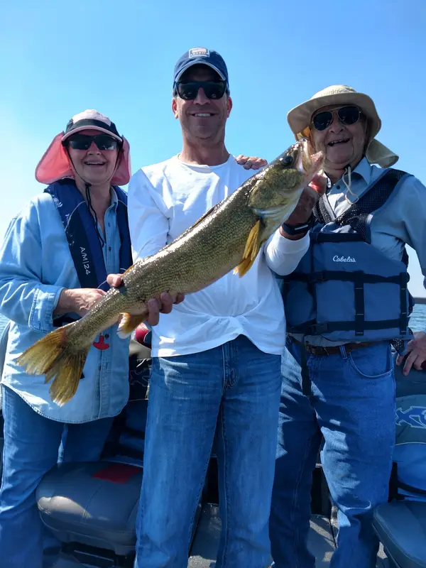
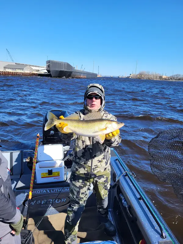
WinneBayGo Fishing Guide is a fishing guide service based in Kaukauna, Wisconsin. They specialize in trolling for walleye on Lake Winnebago and the Bay of Green Bay.
Gallery
Trip details
- Fishing Types
- Walleye Fishing
Fishing spots near WinneBayGo Fishing Guide
Loads the full map of the fishing spots near this listing. We leave it off by default so the page opens fast on mobile data.
- 6229 ReservoirReservoirOutagamie County, WI
- 6224 ReservoirReservoirOutagamie County, WI
- 6223 ReservoirReservoirOutagamie County, WI
- 6263 ReservoirReservoirOutagamie County, WI
- 6201 ReservoirReservoirOutagamie County, WI
- 6233 ReservoirReservoirOutagamie County, WI
- 6187 ReservoirReservoirOutagamie County, WI
- 6183 ReservoirReservoirOutagamie County, WI
Angler reviews
What anglers are saying
- GGeoff Juneau· 4 years ago
Captain Ryan is very knowledgeable and has a great attitude. We caught several fish in just a few hours. Six different species. He was happy to teach us all he was doing. It was an amazing trip. We travel and fish on a regular basis and Ryan is as good a guide as any we have come across. Highly recommend him. We will be return customers for sure.
- KKristy Howard· 2 years ago
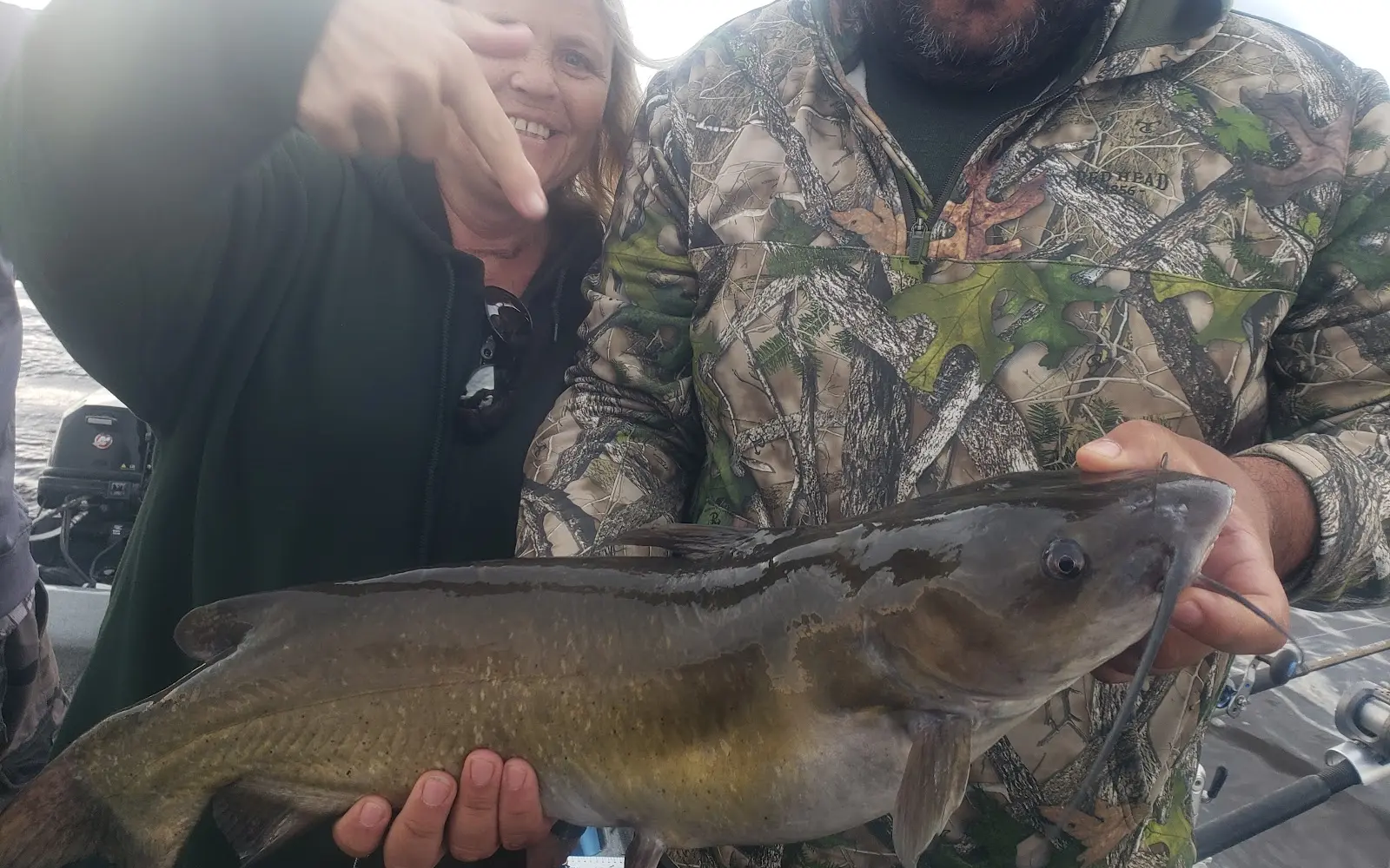
My daughters and I purchased a guided fishing trip for my husband's birthday last fall. We just went out this morning and had a great time! In spite of the rain, we caught our limit of walleye on Lake Winnebago, plus had some fun fighting quite a few sheepshead and a HUGE catfish! Ryan was very personable, knowledgeable and just a great all-around guide. He even cleaned the fish for us to bring home! He was very easy to work with up front as well from getting the gift certificate to scheduling our adventure. We would highly recommend Ryan!
- NNash Herbst· 5 years ago
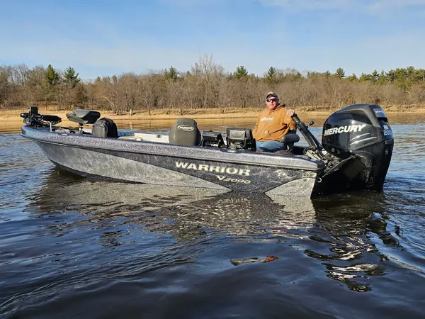
My father and I had a great time fishing with Ryan. It was our first time being able to fish in Green Bay, I have seen a lot of pictures of the nice walleye caught there and always wanted to give it a try. We caught a bunch of beautiful walleyes and had fun doing it! There were several times we were both reeling in fish at the same time. The ride out was very comfortable in a top of the line boat, it’s amazing how it cut through the waves compared to my 16.5’ aluminum boat. Would strongly recommend WinneBayGo Fishing Guide to anyone looking for a great experience!
- BBev Wendt· 5 years ago
We had a great time with captain Ryan. We trolled the bay in Green Bay and had alot of fun catching fish. Ryan had excellent equipment and knowledge of the bay. Would recommend you use him for a great time of fishing.
Reviews powered by Google. Content belongs to its respective authors.
Typical flow by month
1986 to 2026
The water at WinneBayGo Fishing Guide typically runs highest in May, at a median 6,310 cfs, and lowest in August, at 2,030 cfs. The highest flow on record for any single day is 18,300 cfs, in 2018.
| Month | Typical (cfs) | Usual range (cfs) | Relative level |
|---|---|---|---|
| May | 6,310 | 3,300 to 8,210 | |
| June | 5,240 | 2,375 to 8,095 | |
| July | 2,630 | 1,780 to 6,140 | |
| August | 2,030 | 1,600 to 3,560 | |
| September | 2,345 | 1,545 to 4,255 | |
| October | 3,060 | 2,200 to 4,830 | |
| November | 4,365 | 3,150 to 6,100 | |
| December | 3,810 | 3,060 to 4,970 |
Typical is the median of each month’s daily median values, and the usual range runs from the median 25th to the median 75th percentile, across about 40 years of record. Statistics published by the US Geological Survey for Fox River at Appleton, WI (site 04084445). Conditions on any given day can fall well outside the usual range. Check the current reading before you go.
Current conditions
High today
59°F
Wind
13 kt
Gusts 19 kt
Rain chance
5%
Week ahead
Forecast from Open-Meteo global models (NOAA & ECMWF). See full conditions →
More guides in Wisconsin
Also nearby
Other ways to get outside within about an hour of here.
Free tools
Your free outdoor toolkit

Everything Map
Listings, trails, spots, clubs and public land on a single full-screen map. Switch layers on and off, then tap any point for the details.
Open Everything MapFishing Spots
Browse 24,783 named waters, then read the state stocking record: species, size, and when.
Open Fishing SpotsRiver Explorer
Explore named rivers from the USGS hydrography dataset. Filter by water type or whitewater class.
Open River ExplorerRoute Planner
Drop stops on a map and watch distance and drive time add up. Export a GPX or share the link.
Open Route PlannerFishing Clubs
Browse local clubs with meeting info and how to join, or start your own for free.
Open Fishing ClubsLive Conditions
Real-time conditions spot by spot, pulled from public weather feeds, before you commit to the drive.
Open Live Conditions