Lovely Martha Sportfishing
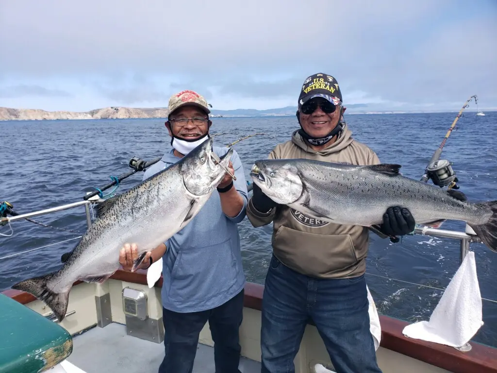
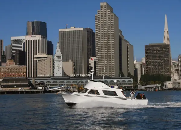
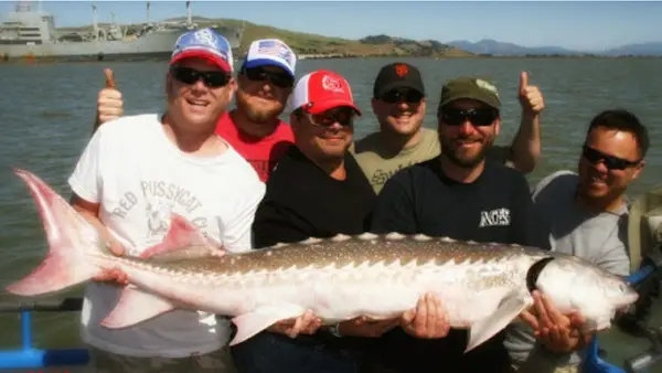
Lovely Martha Sportfishing is a fishing charter operator based in San Francisco, California. The charter targets salmon, rockfish, and lingcod in the San Francisco waters.
Gallery
Trip details
- Fishing Types
- Offshore / Deep Sea, Salmon & Steelhead
Fishing spots near Lovely Martha Sportfishing
Loads the full map of the fishing spots near this listing. We leave it off by default so the page opens fast on mobile data.
- Aquatic CoveBaySan Francisco County, CA
- Lombard Street ReservoirReservoirSan Francisco County, CA
- Gashouse CoveBaySan Francisco County, CA
- Washerwomans Bay (historical)BaySan Francisco County, CA
- Yerba Buena Cove (historical)BaySan Francisco County, CA
- Mission Bay (historical)BaySan Francisco County, CA
- Mountain LakeLakeSan Francisco County, CA
- Golden GateChannelSan Francisco County, CA
Angler reviews
What anglers are saying
- CConnor Bishop· 4 months ago
Best fishing boat in the bay area. Captain Mike and his crew really work hard and make every trip special. I have fished with them 10+ times now and every single trip has been a success. I will be a customer for life with the amazing folks at the Lovely Martha.
- NNatalie Petty· 2 months ago
This is the second time my family has fished with Lovely Martha and both times have been great fun for everyone. The crew was great both times. They work to get you into the fish and if the fish cooperate, you’ll get your limit.
- BBelva· 3 months ago
I’ve had the pleasure to be on the Lovely Martha a few times over the last several years! I’ve caught salmon and Halibut and maybe a cold. It is the highlight of my trip to SanFrancisco and I’m always singing praise about them.Great experience and Willie and Captain Mike and Captain Frank if your lucky are the best in the business. The Lovely Martha is a beautiful boat named after their beautiful Mother! Fish On!!
- JJeffrey w· 9 months ago
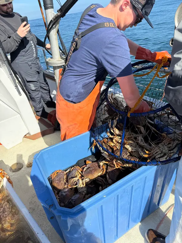
I have been on this boat a few times for halibut and this time crab. Got limits of crab and fish. This year saw his son and some other young deck join the team. SF boats are smaller do there is no Galley for food. The dock has a ladder to climb so you need to be careful.
Reviews powered by Google. Content belongs to its respective authors.
Typical flow by month
2015 to 2026
The water at Lovely Martha Sportfishing typically runs highest in January, at a median 13 cfs, and lowest in October, at 0.1 cfs. The highest flow on record for any single day is 595 cfs, in 2018.
| Month | Typical (cfs) | Usual range (cfs) | Relative level |
|---|---|---|---|
| January | 13 | 4.1 to 36 | |
| February | 7.0 | 2.8 to 30 | |
| March | 8.4 | 1.9 to 26 | |
| April | 5.5 | 1.8 to 11 | |
| May | 2.0 | 1.1 to 3.2 | |
| June | 0.9 | 0.6 to 1.5 | |
| July | 0.5 | 0.3 to 0.9 | |
| August | 0.3 | 0.1 to 0.5 | |
| September | 0.1 | 0.0 to 0.3 | |
| October | 0.1 | 0.0 to 0.3 | |
| November | 0.3 | 0.2 to 1.6 | |
| December | 3.3 | 0.7 to 32 |
Typical is the median of each month’s daily median values, and the usual range runs from the median 25th to the median 75th percentile, across about 12 years of record. Statistics published by the US Geological Survey for Redwood C at Hwy 1 Bridge at Muir Beach CA (site 11460151). Conditions on any given day can fall well outside the usual range. Check the current reading before you go.
Current conditions
Waves
4.4 ft @ 5s
Wind
4 kt
Gusts 21 kt
Water
60°F
Air
56°F
Streamflow
0.1 cfs
Normal (46th)
Water level
0.93 ft
Rain chance
0%
Forecast outlook
Forecast from Open-Meteo global models (NOAA & ECMWF). See full conditions →
More guides in California
Also nearby
Other ways to get outside within about an hour of here.
Free tools
Your free outdoor toolkit

Everything Map
Listings, trails, spots, clubs and public land on a single full-screen map. Switch layers on and off, then tap any point for the details.
Open Everything MapFishing Spots
Browse 24,783 named waters, then read the state stocking record: species, size, and when.
Open Fishing SpotsRiver Explorer
Explore named rivers from the USGS hydrography dataset. Filter by water type or whitewater class.
Open River ExplorerRoute Planner
Drop stops on a map and watch distance and drive time add up. Export a GPX or share the link.
Open Route PlannerFishing Clubs
Browse local clubs with meeting info and how to join, or start your own for free.
Open Fishing ClubsLive Conditions
Real-time conditions spot by spot, pulled from public weather feeds, before you commit to the drive.
Open Live Conditions